Category: Trip report

backpackingblogDestinationsTGO Challenge 2018Trip report

TGO Challenge 2018 part 1 video and pics

Scotland, what a beautiful nation and what an incredible hike Scotland has to offer. Truly incredible experience and one I thoroughly enjoyed. The TGO Challenge is a hiking adventure that is organized once a year since 1980. You have a few different starting points, and a few ending, and you make your own route through the country. Our route started in Lochailort and ended at Dunnottar castle of the coast of Stonehaven – A total hike of about 340km with some of the detours and other site we sent of towards. We did this is 12 days of hiking.

you can either read all of this, or just click on the video and watch all of it..

IMG_0212.PNG
The full route as seen on Viewranger

I flew into Edinburgh, took the direct bus to Glasgow, in Glasgow I sent two packages to myself at the post office that is located right outside the bus stop. I had my resuplies sent to the Inverlochy villas in Fort william where I was staying for the night and Braemar youth hostel. This cost about 3pounds per package.

From Glasgow I met up with Niels blok who has ultralightpedestrian.com, and we took the train up to Lochailort where we arrived at around 23.00 in the evening. Tired, and no place to sleep we pitched the Ultamid 2 in the parking lot right outside the train station. This worked just fine as we arrived on the last train, and the first train wouldn’t start until around 7.30 in the morning.. plenty of time to get sleep.

IMG_2730.jpg

We woke up, packed our shit and after a nice long and healthy fight with the Lochailort inn employees, we were able to get breakfast and check in for the TGO Challenge. Though we were one step away from having to grovel on our hands and knees to get that damn breakfast.

IMG_0213.PNG

From there we made our way into the mountains via the Prince charlies cave, which we didn’t see, along the Loch beoraid where we stopped and ate breakfast at or around the Kinlochbeoraid bothy

IMG_2780.jpg

From there we pushed through the Gleann Donn, a wild trail, or rather no trail, just bogs and rocks to climb up a ravine and down into Glen Finnan where all ambition to climb another ravine was lost and we set up camp at the bothy there.

IMG_2815.jpg

After a nice evening at the camp we decided that the ravine wasn’t for us, so we made a detour around the ravine as you can see in the pic below.

IMG_0214.PNG

That worked out just fine for us and we continued on our journey.

IMG_2876.jpgDay two started with that detour taking us around Beinn an Tuim, though, next time I will probably opt to climb up and over as I don’t care for road walking too much either.

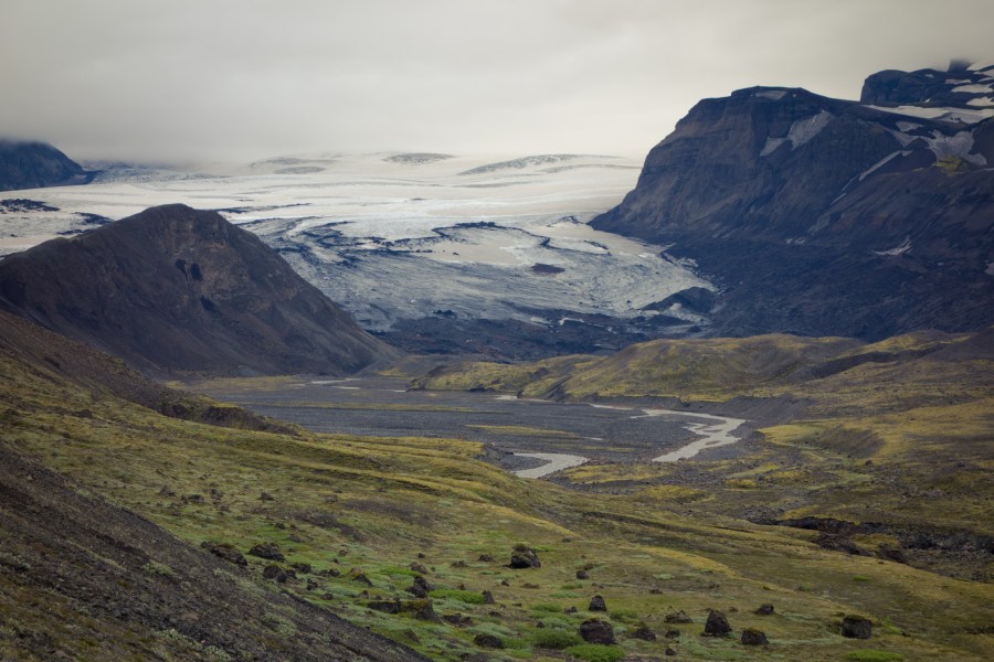
Once we caught up with our route we then made our way along the Leann Fionnlighe which was rather spectacular at times, felt like we were heading into true scandinavien mountains. Large rolling hills, wet bogs, bugs and some waterfalls along the way.

IMG_2910.jpgIMG_2890.jpgIMG_2887.jpg

IMG_0215.PNG

After what turned out to be the worst campsite of the trail, a small little tick infested hell by the water (though the water and view was nice).. We trekked our way into Fort william, ate a burger, drank a beer and changed out my Ultamid 2 for a Terra nova laser 1 competition. Several reasons for that really, 1. I wanted to try a new tent that I had plans on importing and selling 2. I wanted a tent with a smaller footprint and 3. I wanted a little better protection from ticks. My hiking mate Niels had been talking about his horrific experience with Lime disease, and just the whole, spending a week in a hospital nearly dead stuff kind of scared me into submission.. inner tent it would be then.


backpackingblogDestinationsLandscape photographylaugavegur

Trip report: The Laugavegur trail day 4

Emstrur (Botnar) to Þórsmörk

— 15 km, estimated walking time 6-7 hrs, 300m net descent —

dsc07873

Again, I was left breathless by the amazing hike. Glaciers, desert, rivers, mountains and forest all within a 15 kilometer hike. This day starts off in the canyon of Syðri – Emstruá. Here there is a steep path that leads a bridge that runs over the glacier river.

dsc07895

There is something epic about a raging river being fed with a glacier.. simply amazing. I sat here for sometime and ate my breakfast and just enjoyed the incredible view, engrossing my soul completely in the moment.

dsc07894

I learned along this trail that it was time to replace my beloved Haglöfs LIM trail shoes. I decided from this moment on that I would wear trail shoes that had toe protection and better grip. On top of that I realized that I’m not really into video production.. I shot hours and hours of video along this trail and so far haven’t edited anything.. I prefer working with photography.

dsc07910-pano

After this long trek along the sandy, volcanic ash desert everything changes to a kind of mini forest.

dsc07932

dsc07949

This little house just seemed lost in the wilderness – It was the first house I’d seen for days.

dsc07951

The house from a little further out.

dsc07967

dsc07986

After a long walk came this amazing water crossing along the Þröngá river. As always the water is freezing cold, but barely knee high throughout so wading is no problem.

dsc07992
The little village at the bottom of the valley is Porsmork, while I will be staying in Bazar, I wanted to make the little 8 kilometer detour to Porsmork to drink beer and eat peanuts. It was worth the walk. You can even take the bus back to Reykjavik from Porsmork.


From Porsmork I made my way on to Bazar where I would be sleeping for the night.

dsc08015

While this was not Bazar, it was nice nonetheless.. Not really sure what this place was called, but it was nessled between Porsmork and Bazar.

dsc08023

After a quick walk over this glacier river, I soon arrived in Bazar where I would throw up my tent and make camp for the night

Once my tent was setup I made my way to the river, laid down and chilled out for a few hours before heading off to bed. Once again, the Laugavegur trail delivered on it’s incredible views and serene enviroment.

dsc08062

Trail report: the Laugavegur trail day 1
Trail report: the Laugavegur trail day 2
Trail report: the Laugavegur trail day 3
Trail report: the Laugavegur trail day 4
Trail report: the Laugavegur trail day 5

DestinationsLandscape photographylaugavegurPhotographyTrip report

Trip report: The Laugavegur trail day 2

When volcanic desert transforms into a true paradise on earth

Hrafntinnusker to Álftavatn – 12 kilometer from volcano to paradise

DSC07449.jpg

After a day and a half of hiking in rain and cold, finally some sunshine and water. I stopped here and filled up my water bottle, ate an energy bar and called home. This really lifted my spirits.

After what felt like an eternity of walking in rain and snow, after volcanic ash, rock and gravel. A long sleepless night in an unprotected snowy volcanic wasteland.

dsc07467

The Laugavegagur trail transformed itself into a true paradise on earth when I came up over the ridge and looked out upon Alftavatn.

dsc07478-pano

Alftavatn is where most pictures you see of the trail come from, and in the next section you will see why. However to get there you have to walk along a desert wasteland for almost the entirety of the 12 kilometers from Hraftinnusker.

dsc07497
My journey to Alftavatn started after a cold night of “sleep”. On top of that I of course only use trail running shoes. While this is normally never a problem, on this one occasion my feet where frozen until I got my temperature up as the first 5 kilometers of the trail was covered in mushy snow.

dsc07528
It took me about 6 hours to get to Alftavatn from Hraftinnusker, lets just say I was in no hurry at all. While it was cold, wet and at times just all around shitty, I actually enjoyed this part of the trail immensely; granted, more now when I’m sitting at home writing this book.

dsc07601

While the campground looked lovely, I opted for the cabin.. there was actually an available bed! The room here will cost about $50.00.. to me it was worth it that night.

dsc07543

Trip report: The Laugavegur trail day 1
Trip report: The Laugavegur trail day 2
Trip report: The Laugavegur trail day 3
Trip report: The Laugavegur trail day 4
Trip report: The Laugavegur trail day 5

backpackingblogLandscape photographylaugavegurPhotography

The Laugavegur trail day 1

Sometimes it takes me a while to finally get around to doing a trip report. I am working on this as an ebook instead as I can really get the pictures and album to flow better, but I will post the separate days here nonetheless.

This will be a full trip report and information guide for anybody wanting to do the trip themselves. This trip report is divided into 5 days simply because of the diversity and vassness of this trail I simply couldn’t fit it all into one post.

The Adventure begins

I had booked my flight a few months in advance to Reykjavik from Stockholm. The total flight cost around $350 round trip and the light takes about 3 hours. So, in other words Iceland is an obvious choice for most Swedes. I Arrived at Reykjavik international airport and immidiately outside the little airport I found my bus to Reykjavik city center.

dsc07392-2

Once at the city center I took a little walk into Reykjavik center ate a burger, bought a map and some gas for my laugavegur trail hike. There is a gas station about 100 meters away from the bus station where all these supplies can be bought. My bus would be leaving at 13.00 so I had a few hours to spare before heading off to the trail start.

I arrived in Reykjavik at around 10.00 a.m. Finding my way around the airport was a rather straight forward process as there really is only two busses to chose from. I bought my ticket at the BSI desk to the BSI terminal in Reykjavik. After about a 40 minute ride I found myself at the main buss terminal. From here it was just a simple manner of purchasing the “hikers pass” which would get me to either the start in the north at Landmannalaugar or in the south at Porsmork or Skogar and back to Reykjavik.

I decided I really wanted to start north and head south, seemed like a fun way to go to end my journey at the ocean. I’m glad I did as I found the first days along Landamannalaugar and Hrafntinnusker to be rather bleak with the rain and snow.

dsc07397
The Bus ride from Reykjavik takes about 3 and a half hours and I would definitely not recommend trying to hitch hike to the start as there it is literally out in the middle of nowhere. Nobody drives that trail unless they are hiking – and that is mainly just the buses. When I arrived in Landmannalaugar it was rainy and cold. Everyone was bunched into the toilets trying to figure out what they want to do.. Walk or pitch their tents. I also had a difficult time deciding as it was raining like crazy and it was by this time 4 p.m in the afternoon. However, as I had been sitting since my flight left Stockholm, my ass and back were hurting so I opted to walk.

The Hike from Landmannalaugar to Hrafntinnusker is about 12km and takes around 4-5 hours to walk. While it was late, I really just needed to walk. This part of the trail was marked by snow, rain and steaming volcanic hills. Landmannalaugar is the only part along the trail where you can swim in the hot springs. I probably should have stayed, but I couldn’t be bothered to sit still any longer.

And so, I made my way to look over the hotsprings, looked at all the hikers huddled in the toilets, waved and made my way.

dsc07401

Landmannalaugar to Hrafntinnusker

12 kilometers – takes about 4-5 hours to walk

This part of the trail from Landmannalaugar to Hrafntinnusker was cold and wet the whole way. I was happy for it to be done. When I do this trail again it will be in August and not June, the trial in June is very wet, snowy and sometimes this means we just want to get through it all instead of taking time to enjoy every second.

dsc07403

The first day was wet, cold and rainy with dashes of snow. With that said, the beauty was there.

dsc07413

There was quite a few people stopping me along this part of the trail asking “how far is camp..” I seemed to be the only one heading south!

DSC07417.jpg

The warmth of the volcano underneath kept the ground nice and toasty.

dsc07421

dsc07442

By the end of this first day I had reached my limits. A long night before when I didn’t get any sleep, a flight, a long bus ride, never ending rain and cold. I was so tired that I didn’t bother taking pictures from that first camp at Hrafntinnusker. In my opinion the campsite wasn’t the best as it was surrounded by snow and no wind protection. I really wanted a warm bed in the cabin, but alas it was fully booked.

dsc07444

Trip report: The Laugavegur trail day 1
Trip report: The Laugavegur trail day 2
Trip report: The Laugavegur trail day 3
Trip report: The Laugavegur trail day 4
Trip report: The Laugavegur trail day 5


DestinationsLandscape photographyPhotographyTravel PhotographyTrip report

Along the Laugavegur trail – Iceland pictures part 2

Here is part two of my pictures along the Laugavegur trail – gallery of Iceland. All pictures where taken with the Sony RX 100 I, edited in lightroom. If you steal my pictures atleast leave a link to my site and let me know where they will be seen. Thanks!

The first part of this series you can find here

For information about the trail – how to get there, map and general good to new info click here

For information with regards to my gear that I brought along the trail click here

Read More

Geartrip planningTrip report

Planning for Iceland part 2 – the gear

Ok, so the first part of this planning process was the actual trip, I find no new info here that is worth adding to the trip planning, (well except that this trip is now a solo trek as my hiking buddy is rather sick). Instead I will focus on what gear I will be bringing and why. Basically I have same setup but I made a few changes this time around. I will start with the complete gear list first: Read More

DestinationsTrip report

Planning for The Laugavegur trail iceland – part 1

In two weeks a friend and I will be heading out to Iceland to hike along the 75 kilometer Laugavegur trail. While the trail is not known for being overly difficult I will be planning to take the full amount of food with me as there are no places to eat along the way. On top of that as we will be there in June there could be some risk for colder nights and still some snow left on the trail. (Though I think the risk is minimal here I will still pack accordingly)

Update: trail now complete and I will update this post with more up to date info for anyone wanting to make the trip themselves.

We plan on stretching the trip out over 5-6 days and spend two nights, if possible, in some of the huts along the way. Sometimes it’s pretty nice to have a hut and warm shower if the possibility presents itself. Read More

DestinationsTrip report

Finally winter…ish.. a hike along Sörmlandsleden

So the hike continues where I left off last week.. I walked from alby to Haninge last week, that you can read about here. As you can see from the pictures, the weather was fantastic! about -1 celcius and sunny. An absolutely lovely day to be out. I started in Haninge and ended in Lida – on my maps about 27 kilometers. My adventure started at the OK28 gas station in Haninge and really you can say it starts at Rudan as you can see from the pics below. I don’y know if I would dare go out on the ice right now, as it’s pretty thin, but that didn’t seem to bother these guys too much. Read More

Trip report

A long days hike along Sörmlandsleden

What was initially meant to be a nice walk in the woods split up with dinner by campfire and a cold beer, ended up being a 28kilometer walk and sore feet. My thought was that I needed to get in the woods and have some “me” time. Which is usually the case when I’m feeling the winter blues. Or for the most part, I get down whenever I don’t venture off into the woods with my gear on my back. However, once I got out in the woods I found in my soul what I really needed was a long brutal walk…  And that was exactly what I got.  Read More